


Keowee Voting District, Oconee County, South Carolina
About
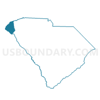
Outline

Summary
| Unique Area Identifier | 666435 |
| Name | Keowee Voting District |
| County | Oconee County |
| State | South Carolina |
| Area (square miles) | 37.47 |
| Land Area (square miles) | 27.87 |
| Water Area (square miles) | 9.60 |
| % of Land Area | 74.38 |
| % of Water Area | 25.62 |
| Latitude of the Internal Point | 34.77736120 |
| Longtitude of the Internal Point | -82.94807230 |
Maps


Graphs
Select a template below for downloading or customizing gragh for Keowee Voting District, Oconee County, South Carolina


Neighbors
Neighoring Voting District (by Name) Neighboring Voting District on the Map
- Bountyland Voting District, Oconee County, SC
- Lawrence Chapel Voting District, Pickens County, SC
- Mountain View Voting District, Pickens County, SC
- Newry-Cornith Voting District, Oconee County, SC
- Salem Voting District, Oconee County, SC
- Seneca No. 1, Seneca No. 2, Seneca No. 3, Seneca No. 4 Voting District, Oconee County, SC
- Stamp Creek Voting District, Oconee County, SC
- Tamasee Voting District, Oconee County, SC
- Walhalla No. 1, Walhalla No. 2 Voting District, Oconee County, SC
- West Union Voting District, Oconee County, SC
Top 10 Neighboring County Subdivision (by Population) Neighboring County Subdivision on the Map
- Seneca CCD, Oconee County, SC (25,923)
- Clemson CCD, Pickens County, SC (19,753)
- Walhalla CCD, Oconee County, SC (19,288)
- Six Mile CCD, Pickens County, SC (10,079)
- Salem CCD, Oconee County, SC (5,764)
Top 10 Neighboring Place (by Population) Neighboring Place on the Map
Top 10 Neighboring Unified School District (by Population) Neighboring Unified School District on the Map
Top 10 Neighboring State Legislative District Lower Chamber (by Population) Neighboring State Legislative District Lower Chamber on the Map
- State House District 2, SC (37,913)
- State House District 3, SC (36,002)
- State House District 1, SC (34,202)
Top 10 Neighboring State Legislative District Upper Chamber (by Population) Neighboring State Legislative District Upper Chamber on the Map
Top 10 Neighboring 111th Congressional District (by Population) Neighboring 111th Congressional District on the Map
Top 10 Neighboring Census Tract (by Population) Neighboring Census Tract on the Map
- Census Tract 303, Oconee County, SC (6,145)
- Census Tract 302, Oconee County, SC (5,764)
- Census Tract 306.02, Oconee County, SC (4,447)
- Census Tract 306.01, Oconee County, SC (4,443)
- Census Tract 102, Pickens County, SC (4,410)
- Census Tract 305, Oconee County, SC (4,375)
- Census Tract 112.04, Pickens County, SC (4,368)
- Census Tract 304.02, Oconee County, SC (1,779)
Top 10 Neighboring 5-Digit ZIP Code Tabulation Area (by Population) Neighboring 5-Digit ZIP Code Tabulation Area on the Map
- 29630, SC (14,186)
- 29672, SC (11,868)
- 29691, SC (11,333)
- 29676, SC (5,201)
- 29696, SC (4,125)
- 29682, SC (3,818)
- 29665, SC (127)